Park City Snow Conditions: A Warm Weekend and What's Ahead
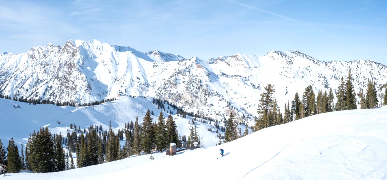
If you were on the mountain in Park City this past weekend, you already know the story: it was warm, sunny, and honestly felt more like late April than early March. But the snow is deep, the terrain is open, and there's still plenty of season left to be had. Here's a full breakdown of where things stand.
The Weekend: Spring Vibes in Early March
This past weekend (March 7-8) arrived on the heels of a warmer-than-normal stretch that has defined much of the 2025-26 winter. According to the National Weather Service, this has been the warmest meteorological winter on record at Salt Lake City International Airport, with an average temperature of 40.7F across December through February. That warmth carried squarely into the weekend.
Mid-mountain temperatures hovered in the 40s and 50s over the weekend, with Sunday, March 8 seeing a high of around 51F at resort elevation. Skies were mostly overcast, with winds from the east-southeast at a manageable 6-7 mph. It was the kind of spring-skiing day where you peel off a layer by 10 a.m. and reach for sunscreen by noon. There was no new snow recorded on Saturday or Sunday.
Despite the warm weekend, the snowpack tells a more encouraging story. The season-to-date snowfall at Park City stands at 157 inches, and the base depth as of Monday, March 9 is a healthy 68-69 inches at the snow stake elevation of 9,250 feet. That's a solid late-season foundation that's been holding up well even through the warmer stretches.
Early March Snowfall: A Brief But Welcome Jolt
Before the warm weekend settled in, early March delivered some welcome relief. A quick-moving cold front swept through the area around Monday, March 2, bringing a band of heavy snow that dropped 3-7 inches at Deer Valley/PCMR elevations. The Cottonwood Canyons fared even better with 6-11 inches from that same system, and some thunder and graupel accompanied the passage of the front - always a sign of a punchy, energetic storm.
Then, between March 4 and March 6, another round of snowfall came through. Mid-mountain models tracked roughly 4 inches of additional accumulation over those 48 hours. In total, Park City saw approximately 22 inches of snowfall in the past seven days heading into the weekend: a solid, if not exceptional, early March stretch.
Current Mountain Status: Plenty of Terrain Open
With all that snow in the bank, Park City Mountain Resort is operating in strong shape. As of Monday, March 9:
- 240 out of 350 runs are open
- 40 out of 41 lifts are running
- 4 terrain parks are open, featuring 66 features and 10 jumps
- Groomer picks for today include Mid-Mountain Meadows and King Con Run at Mountain Village, and Red Pine Road and White Pine at Canyons Village
The piste conditions are machine-groomed, making for smooth carving on the frontside, though the warm temperatures over the weekend will have softened things up considerably on sun-exposed runs. If you're chasing the best snow, north-facing and shaded terrain will hold quality the longest.
What's Ahead: High Pressure Takes Over
The honest news for powder seekers: the short-term forecast doesn't look particularly stormy. As of Monday, March 9, Ski Utah's OpenSnow forecast notes that high pressure will be largely in control for the next two weeks, with only a couple of brush-by systems possible that could bring light snow showers to far northern Utah. Otherwise, it's dry and mild weather on the horizon.
The next few days at Park City look like this:
- Monday, March 9: Sunny, high near 44F, gusty southwest winds up to 30 mph
- Tuesday, March 10: Partly cloudy, high around 55F, low around 36F
- Through the week: Continued freeze-thaw conditions, with daytime highs in the low-to-mid 50s and overnight lows dipping back near freezing
There is a small amount of snowfall, roughly 0.4 inches, in the longer-range outlook for the night of Sunday, March 15, but nothing significant is expected before then.
The Bottom Line
Park City is in a classic late-winter, early-spring ski mode right now. The base is deep, the terrain is largely open, and the resort is running smoothly, but fresh powder days will be the exception rather than the rule for the foreseeable future. If you're heading up this week, expect excellent groomed conditions in the morning, soft and friendly snow by midday, and that undeniable spring-skiing energy that Park City does so well.
The season runs through April 21, 2026, so there's still over six weeks left to take advantage of that 157-inch season total. Get out there.
Snow data sourced from Ski Utah, SnowStash, Snow-Forecast.com, and TownLift Park City. Conditions as of March 9, 2026.